MOUNTAIN TRAIL RACE
The Emei Mountain Race features 3 race courses with distances ranging from 10K, 27K, and 55K, with an additional 35K 2-day hiking course. Perfect for all types of runners from casual runners doing the 10K course to seasoned ultramarathon runners doing the 55K course for the ultimate challenge. Each route provides a unique challenge that becomes harder the longer you go, yet every course gives you the incredible breathtaking experience of the Emei Mountain. Hands down, this is a dream adventure race that must be experienced by adventure runners around the world!
10K COURSE
Xiaoping Road Experience Group
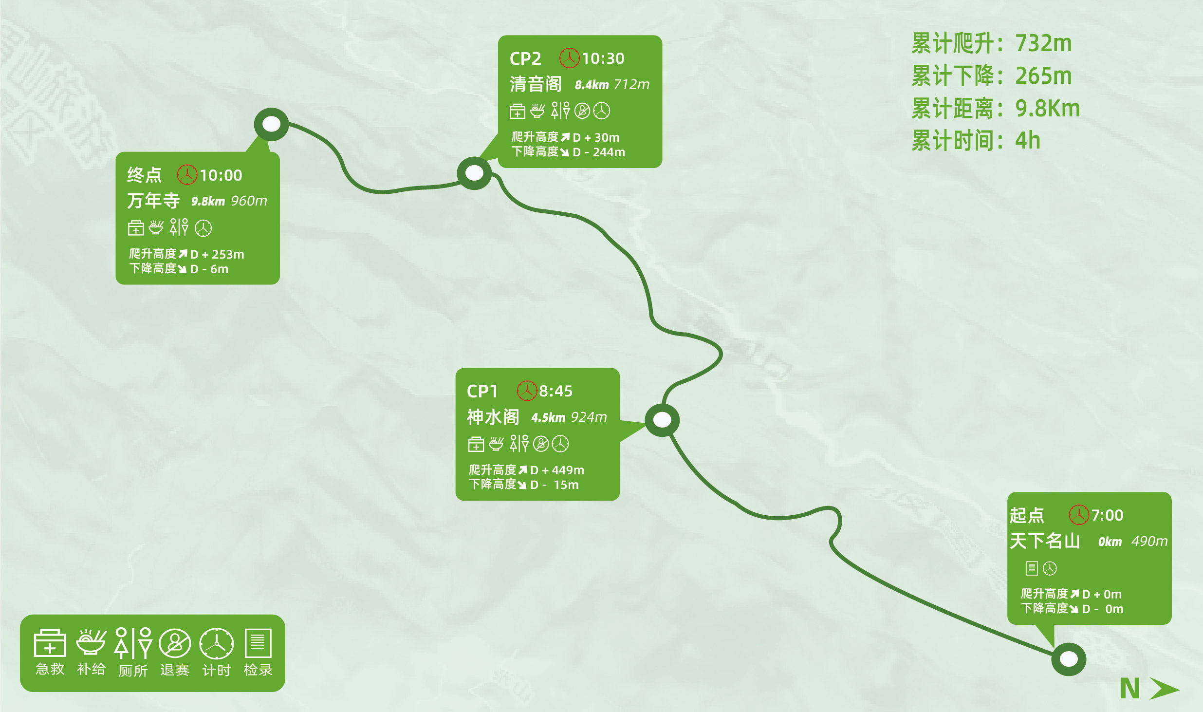
Route: World Famous Mountain Archway (start) > CP1 Shenshui Pavilion > CP2 Qingyin Pavilion > Wannian Temple (finish)
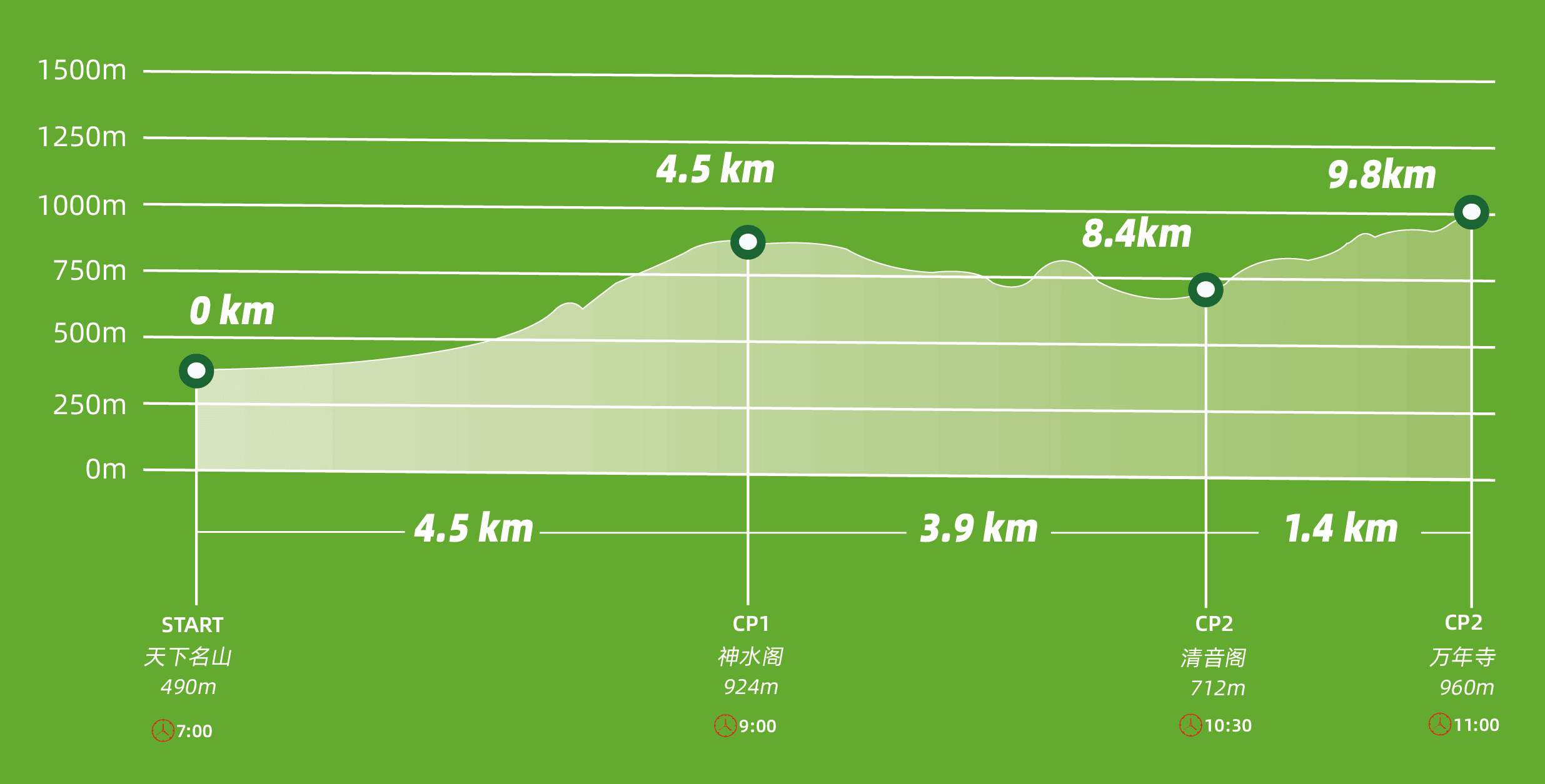
The total length of the track is 10 kilometers, with a cumulative climb of 732 meters and a cumulative descent of 265 meters. The starting point is 490 meters above sea level and the highest altitude is 1020 meters. The entire 10 kilometers route is in the scenic area of Mount Emei and is ideal for road runners who want the best experience.
The map and elevation profile below shows the station locations, cut-off times, and distance between each checkpoint.
27K COURSE
Quick Climbing Golden Summit Challenge Group
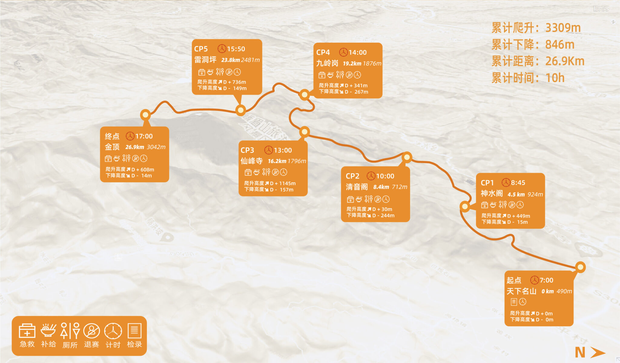
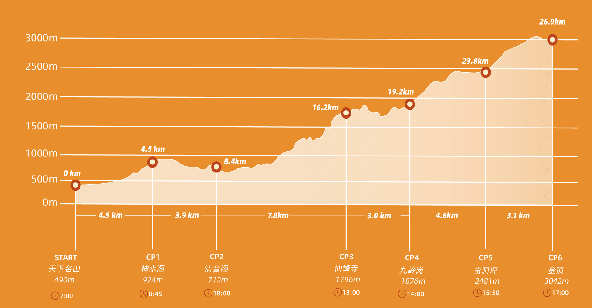
Route: World Famous Mountain Archway (start) > CP1 Shenshui Pavilion > CP2 Qingyin Pavilion > CP3 Xianfeng Temple > CP4 Jiulinggang > CP5 Leidongping > Golden Summit (finish)
The total length of the route is approximately 27 kilometers, with a cumulative climb of 3309 meters and a cumulative descent of 846 meters. The starting point is 490 meters above sea level, the highest altitude is 3079 meters, the lowest altitude is 490 meters, and the average altitude is 1508 meters. The entire 27 kilometers route is in the scenic area of Mount Emei and is ideal for runners looking to elevate their experience to the next level with more serious mountain climbing.
The map and elevation profile below shows the station locations, cut-off times, and distance between each checkpoint.
55K COURSE
Cross-country group of Emei Secret Path
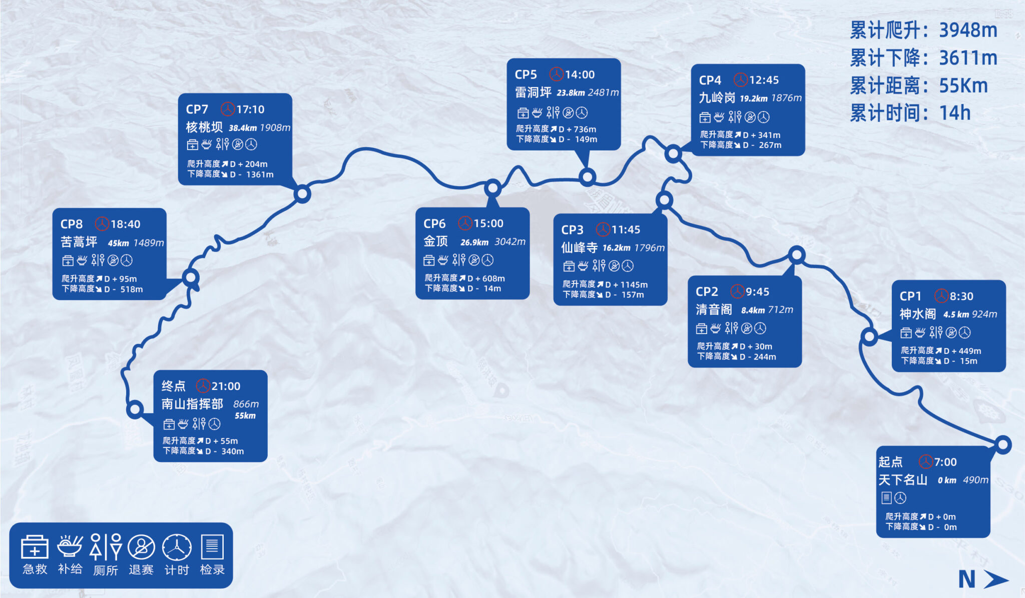
Route: World Famous Mountain Archway (start) > CP1 Shenshui Pavilion > CP2 Qingyin Pavilion > CP3 Xianfeng Temple > CP4 Jiulinggang > CP5 Leidongping > CP6 Jinding > CP7 Walnut Dam > CP9 Kuhaoping > Nanshan Headquarters (finish)
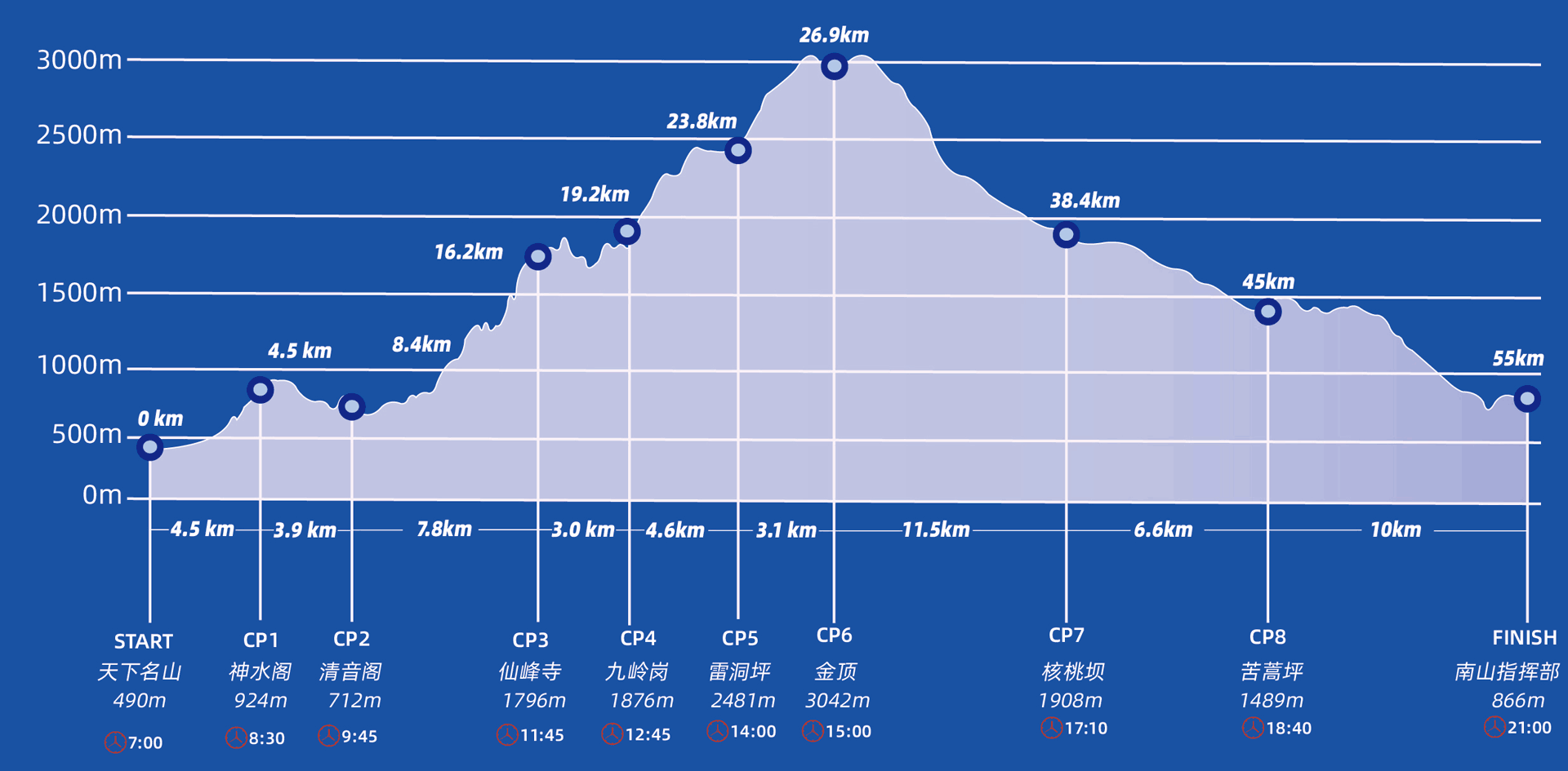
The total length of the course is 55 kilometers, the accumulative climb is 3948 meters, the starting point is 490 meters above sea level, the highest point Wanfoding is 3099 meters above sea level, the finishing point is 866 meters above sea level, and the average altitude is 2000 meters above sea level. Among them, there are 29 kilometers of roads (steps and trails) in Mount Emei, 15 kilometers of secret trails in Houshan Longchi, and 11 kilometers of rural roads. This race is ideal for ultra and trail runners to get the full Mount Emei experience.
The map and elevation profile below shows the station locations, cut-off times, and distance between each checkpoint.
35K 2-DAY HIKING COURSE
Two-day Flower Appreciation Hiking Group
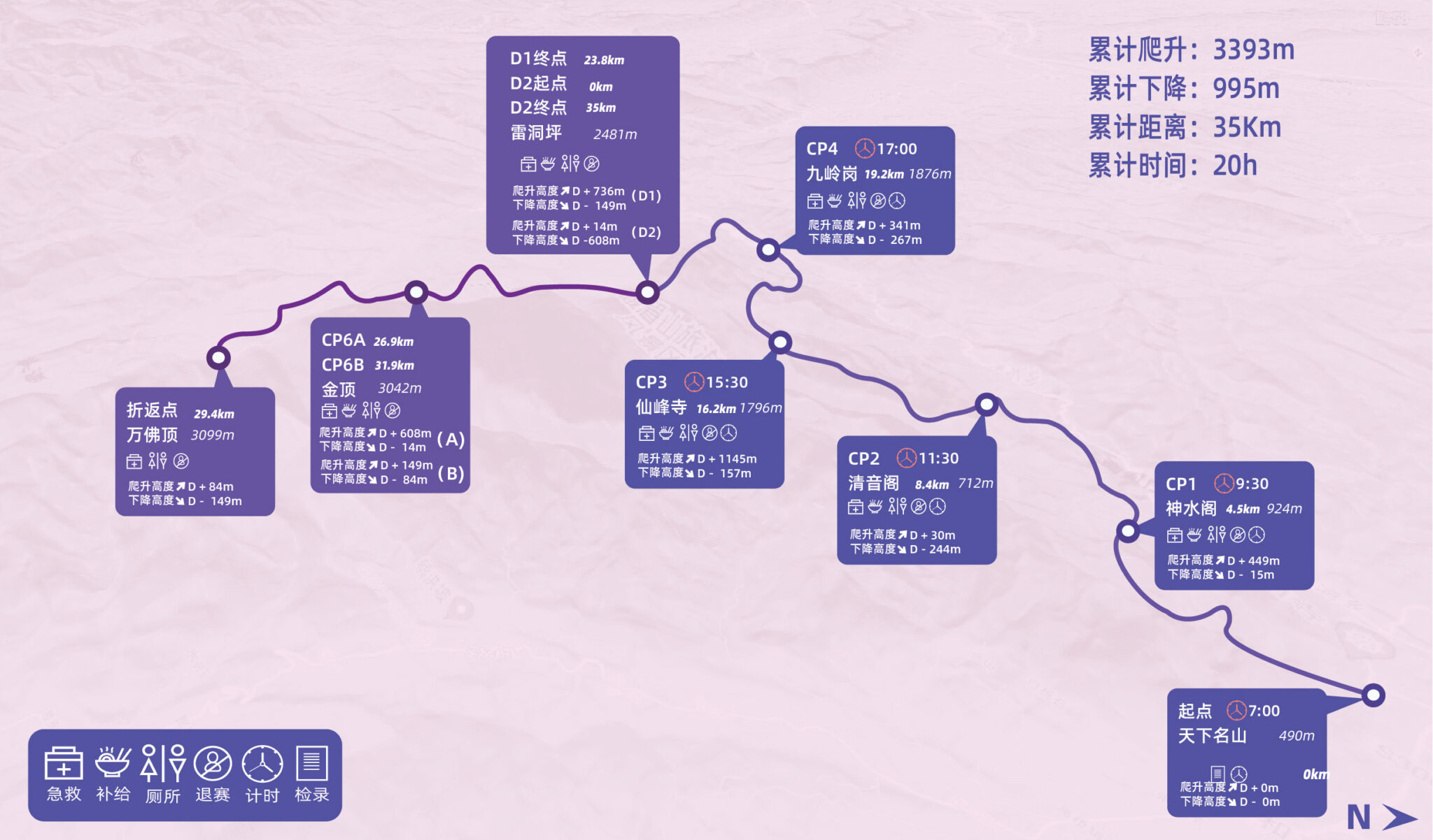
Route: World Famous Mountain Archway (start) > CP1 Shenshui Pavilion > CP2 Qingyin Pavilion > CP3 Xianfeng Temple > CP4 Jiulinggang > Leidongping (Day 1 finish/Day 2 start) > Golden Summit > Wanfoding (u-turn back) > Golden Summit > Leidongping (finish)
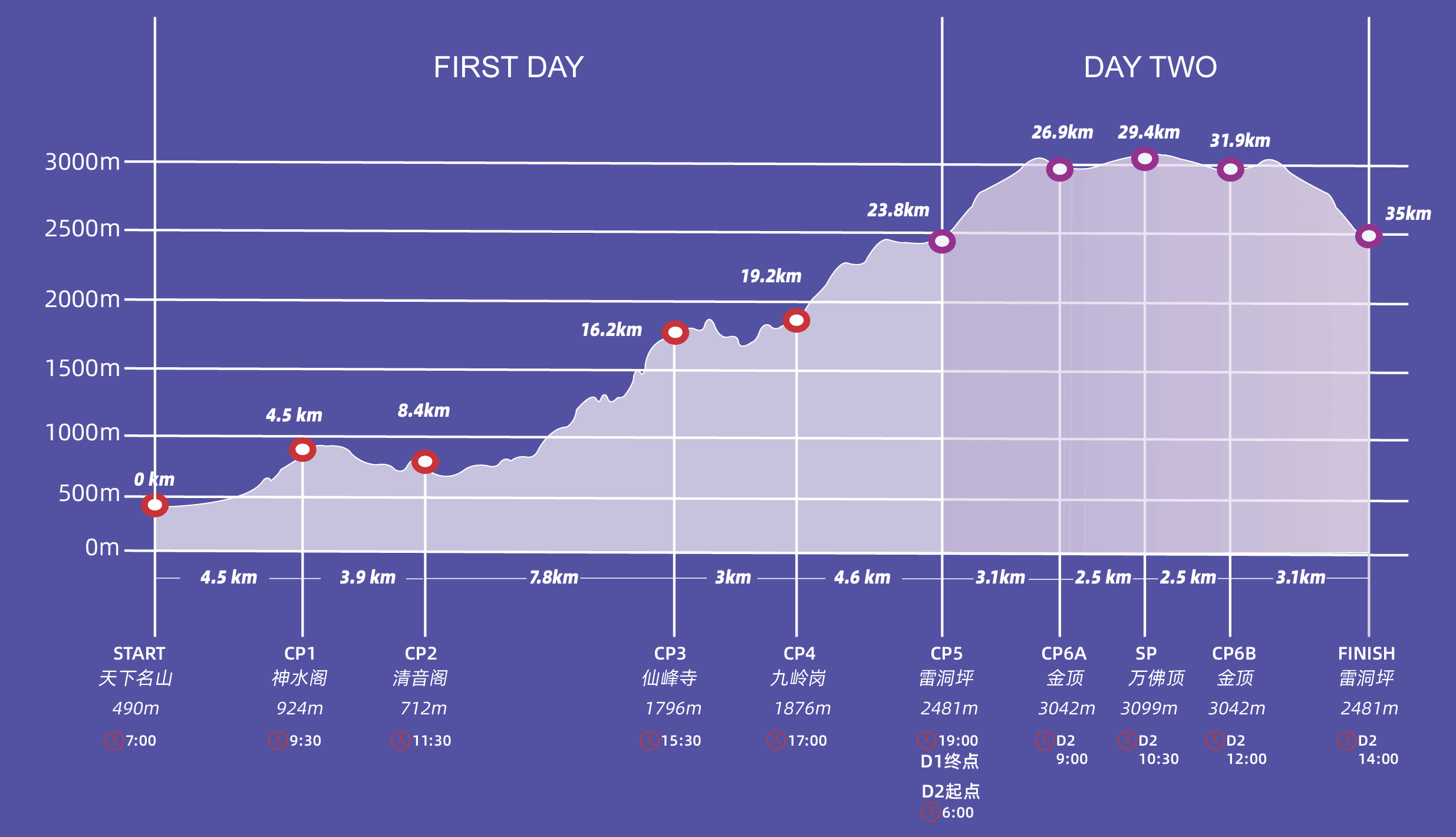
The total length of the track is 35 kilometers, with a cumulative climb of 3393 meters. The starting point is 490 meters above sea level, the highest point Wanfoding is 3099 meters above sea level, and the ending point is 2481 meters above sea level at Leidongping, with an average altitude of 2000 meters. The route consists of roads, steps, and trails in Mount Emei Scenic Area. This is ideal for those who are looking to maximize the Mount Emei experience by taking in the sights, beauty, and nature without racing through with the runners.
Entry includes two meals and lodging in Leo Dongping.
The map and elevation profile below shows the station locations, cut-off times, and distance between each checkpoint.
SUPPLIES AT CHECKPOINTS
Each station will have the following essentials to help you rehydrate and refuel during the race.
- Water
- Sports drink
- Fruit
- Vegetables
- Nuts
- First Aid
Some stations may have additional food items including:
- Hot food
- Bread
- Soda
- Beer
- Noodles
- Pickles
DISCLIAMER
Please note that event information here represents what is planned for the event. Locations, routes, schedules, adjustments, and changes may apply depending on conditions, availability, late participation entries, and improvements. The event strives to improve for the best experience.
